


Modernise flood damage assessments to protect haor farmers

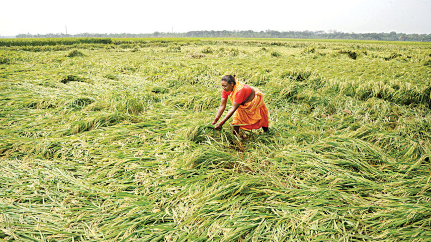
Bangladesh’s haor region is both an ecological treasure and one of the country’s most important centres of Boro rice production. During the monsoon, its vast bowl-shaped depressions turn into an inland sea. In the dry season, the same landscape becomes an extensive agricultural zone on which millions of farmers, labourers, traders, and consumers depend.
This seasonal transformation also makes the haor exceptionally vulnerable. A few days of intense rainfall in Bangladesh and the upstream catchments of Meghalaya, Assam, and Tripura can rapidly raise river levels and inundate standing Boro rice shortly before harvest. By then, farmers have already invested heavily in seed, fertiliser, irrigation, labour, and machinery. A flood arriving even one or two weeks before harvesting can therefore wipe out an entire season’s income.

In such circumstances, reliable estimates of loss and damage are essential for timely compensation, disaster-relief allocation, and recovery planning. Traditional field-based assessments are often slow and labour-intensive and may not capture the full extent of the damage. Satellite remote sensing, by contrast, can provide rapid and spatially detailed estimates of flood extent, damaged rice area, and associated losses.
The flash flood during the 2025–26 Boro season demonstrates how serious this risk has become. To the disaster scale, the Agromet Lab of the Bangladesh Rice Research Institute (BRRI) conducted a satellite-based assessment covering seven haor districts: Sunamganj, Netrokona, Kishoreganj, Habiganj, Sylhet, Moulvibazar, and Brahmanbaria.
The study estimated that 124,972 hectares were inundated, equivalent to 13.3 percent of the cultivated area. Nearly all of the flooded land (120,081 hectares, or 96.1 percent of total inundated land) consisted of active Boro rice fields. This means the flood primarily affected standing crops rather than uncultivated land. Sunamganj recorded the largest inundated area, followed by Habiganj and Moulvibazar.
The credibility of the satellite assessment is strengthened by its estimate of the total area under Boro cultivation. Remote-sensing analysis identified 940,004 hectares of active Boro rice across the seven districts, only 2.5 percent lower than the Department of Agricultural Extension’s (DAE) estimate of 963,694 hectares. The two methods were therefore broadly consistent in identifying the overall cultivated area. However, notable district-level differences remained. DAE estimates were considerably higher in Netrokona and Moulvibazar, while satellite estimates were higher in Sylhet and Sunamganj.
The sharpest difference emerged in the assessment of flood damage. The satellite study estimated that 120,081 hectares of Boro rice were damaged, representing 12.77 percent of the area under cultivation. Sunamganj suffered the largest damaged area, at 43,797 hectares, followed by Habiganj with 24,576 hectares and Moulvibazar with 14,273 hectares.
By comparison, DAE reported a total of 65,236 hectares of damaged Boro rice, equivalent to a damage rate of 6.77 percent. The satellite estimate was therefore 1.84 times higher than the official field-based estimate. Although both approaches identified broadly similar affected districts, satellite mapping detected a much wider extent of crop damage.
The difference was equally significant in estimated production losses. Satellite analysis placed the loss at 508,856 tonnes of rice, compared with the DAE estimate of 288,783 tonnes. The satellite-based figure was 1.76 times higher, representing an additional loss of approximately 220,073 tonnes. The largest production loss occurred in Sunamganj, where an estimated 181,757 tonnes were lost. Habiganj followed with 104,693 tonnes, while Moulvibazar lost an estimated 58,090 tonnes. The satellite assessment also identified a broader high-loss zone than the one reflected in the official field reports.
The findings do not stand alone. The Centre for Policy Dialogue (CPD) conducted an independent assessment using a different method. CPD estimated that 122,016 hectares of rice were damaged, remarkably close to the satellite estimate of 120,081 hectares. Both figures were almost twice the DAE estimate of 65,236 hectares. Production-loss estimates varied more widely. CPD estimated a loss of 339,449 tonnes of rice, while the satellite-based study estimated 508,856 tonnes and DAE reported 288,783 tonnes. Despite the differences, both independent assessments placed the loss above the official field estimate.
The agreement between the satellite study and CPD is particularly important. Both identified Sunamganj and Habiganj among the worst-affected districts and reached similar conclusions about the extent of cultivated and damaged rice areas. CPD also recommended using Sentinel satellite data to assess flood losses within 72 hours of an event, broadly supporting the approach applied in the study conducted by BRRI.
However, these comparisons should not be viewed simply as a dispute over which institution produced the correct number. Field surveys remain essential, particularly for identifying affected farmers, evaluating field-level crop conditions, and verifying losses. Immediately after a major flood, field officers often face serious constraints, including inundated roads, inaccessible villages, limited personnel, and pressure to submit estimates quickly. Satellite observations can provide a rapid and spatially comprehensive picture of inundation and crop damage.
Nevertheless, this approach also has limitations. Cloud cover may restrict optical imagery, classification methods may introduce uncertainty, and moderate-resolution images may miss small or fragmented fields. Production losses may also vary according to crop variety, growth stage, and field management. Most importantly, the BRRI assessment primarily captured losses to standing crops. Paddy that had already been harvested and was drying on threshing floors, roadsides, or homestead yards may also have been damaged or destroyed, but such losses fell outside the satellite estimate. The actual flood-related loss may therefore have been somewhat higher.
Hence, the takeaway is not that satellite analysis should replace field surveys. Rather, Bangladesh needs an integrated assessment system that combines the strengths of both. A standard post-flood protocol should be introduced under which preliminary satellite maps of inundation, damaged crop area, and likely production loss are produced within 72 hours. These findings should then be verified through rapid, statistically designed ground surveys and integrated with DAE records, digital land maps, and farmer databases.
Such a system would produce faster and more credible estimates while reducing the risk of omission, duplication, and arbitrary compensation. It would also help ensure that relief, financial assistance, and recovery support reach the farmers and locations that need them most.
Haor farmers cannot be protected from every flood, but they can and must be protected from delayed assessments, incomplete loss records, and poorly targeted assistance. The evidence from the 2025–26 flood shows that Bangladesh already has the technological capacity to improve the system. What is now required is the institutional commitment to use it.
Dr Niaz Md Farhat Rahman is principal scientific officer at the Bangladesh Rice Research Institute (BRRI) and was the team leader of the assessment discussed in this article. He can be reached
at niaz.sust@gmail.com.
Views expressed in this article are the author's own.
Follow The Daily Star Opinion on Facebook for the latest opinions, commentaries, and analyses by experts and professionals. To contribute your article or letter to The Daily Star Opinion, see our guidelines for submission.
 For all latest news, follow The Daily Star's Google News channel.
Comments