


Our geodiversity deserves protection, just like our biodiversity

Every October 6, the world observes International Geodiversity Day, a Unesco-recognised occasion meant to give the natural foundations of our planet the same attention we reserve for its living inhabitants. For Bangladesh, a country whose entire existence is negotiated with rivers, deltas, coasts, and hills, this day should not pass as another item on the calendar. It should mark a time when we name something we have always lived with but rarely spoken about: geodiversity.
Geodiversity is the natural variety of rocks, minerals, fossils, soils, landforms, and the physical processes—erosion, transportation, deposition or sedimentation, upliftment, flooding, etc—that shape the globe. Together with biodiversity, geodiversity constitutes nature’s full diversity. For Bangladesh, this is seen in the Bengal delta constantly rebuilding itself, the eroding Bay of Bengal shoreline, the hills of Sylhet and Chattogram, the Pleistocene terraces of the Madhupur and Barind tracts, and the alluvial soils and aquifers that feed over 170 million people.

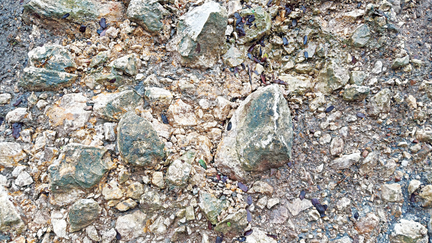
Bangladesh has already taken its first formal action in the field of geoconservation. In 2017, the Ministry of Power, Energy, and Mineral Resources designated about 22.59 acres along the Piyain River in Jaflong, Sylhet as the country’s first officially recognised geological heritage site to preserve Bangladesh’s sole outcropping of Eocene-age limestone, the Kopili Shale layers and the boulder beds for the use of geology students and researchers throughout the nation. Responsibility for maintaining the site lies with the Geological Survey of Bangladesh (GSB), the nation’s nodal earth-science organisation, which has held this status since the notification was published.
The fact that there is already an institutional body in charge is itself a valuable feature since most countries which are just beginning to develop geoconservation programmes do not have it—exactly the kind of acknowledgement that academics claim is needed everywhere: a legal designation supported by a responsible authority stating that a land is important and must be studied rather than removed.
Outside specialist circles, however, very few Bangladeshis are aware of Jaflong’s geoheritage status, and the GSB’s role remains mainly administrative rather than public. It is worth mentioning that the scientists concerned have done an outstanding job protecting the geological heritage site.
The same thing is true in the Lalmai Hill region of Cumilla, as recent surveys have identified 153 fossil wood artefacts, including hand axes, scrapers, celts, blades, and burins. Prehistoric humans produced the tools from petrified wood that was exposed by the Plio-Pleistocene Dupi Tila formation. This finding illustrates the link between geodiversity and human history; the same geological process that caused the wood to become fossilised also caused the hills to rise, and the hard timber enabled some of the earliest toolmakers in South Asia to make their tools. There is already folklore among local communities regarding fossil wood, in which it is referred to as the “asurer haar” (“bone of a demon”). This demonstrates that the geoheritage has been culturally significant for many generations, even though it has not received official recognition. Lalmai should therefore be designated as our next geoheritage site, serving as the basis for a national inventory.
Historically, global conservation policy has prioritised biodiversity while often neglecting nature’s physical components. According to Murray Gray, honorary professor of Geography at Queen Mary University of London, these natural elements provide essential “geosystem services,” such as water filtration, flood regulation, carbon storage, the supply of building materials and groundwater, and unique geological knowledge, as rocks and sediments serve as the sole record of earth’s past climates. Groundwater stored within geological layers sustains river flow during dry periods, while rock and sediment strata purify polluted surface water before it enters aquifers. The natural weathering of rocks also contributes to soil formation, which is essential for agriculture and erosion control, both of which are critical for food security in Bangladesh. Diverse terrain, soils, and water systems provide insurance against environmental disruptions. Such variety enables communities to adapt more effectively to changing conditions. In Bangladesh, where sea-level rise, riverbank erosion, and cyclones are prevalent, the benefits of geodiversity are evident. Natural river levees, coastal dunes, and floodplains offer flood protection that engineered structures often cannot achieve.
A GIS-based risk assessment carried out in 2025 on 184 cultural heritage sites in 19 coastal districts of Bangladesh found that 67.39 percent already face a high level of risk due to sea-level rise, surface water salinity, and low elevation. Only 1.63 percent of sites are considered low risk, and no sites are classified as very low risk. Bagerhat, which houses the Unesco World Heritage Site known as the Sixty Dome Mosque, along with Satkhira and Khulna, where the Sundarbans are situated, were identified as the most critical vulnerability hotspots. These results reflect the current, well-documented situation and the geomorphological processes that make the delta geodiverse, as it is a young, low-lying, and actively subsiding landscape. Protecting heritage sites in the coastal area requires a comprehensive understanding of the underlying geology.
Academics have identified four main challenges when it comes to providing safeguards for geodiverse sites: recognition, understanding, conservation, and utilisation. “Recognition” requires that geodiversity is understood broadly, not just within geology departments. For “understanding,” curricula should cover delta formation and sites such as Lalmai, enabling Bangladeshis to engage with geoscience and influence their future. “Conservation” involves systematically protecting key geosites, expanding efforts from Jaflong to include the Chittagong Hill Tracts, Saint Martin’s Island, and Lalmai Hills. “Utilisation” means acknowledging that sand, clay, and groundwater renew slowly, so extraction must consider their limited renewability.
International Geodiversity Day will be celebrated worldwide this year under the theme “Geodiversity on our doorstep,” which aims to raise awareness of the connection between geodiversity and living systems, highlight its social benefits, and support geoparks, protected areas, and geosites by linking them to cultural and historical heritage. It is important to acknowledge rocks, soils, rivers, landforms, and geoheritage sites in Bangladesh as valuable forms of living capital. Geology still carries out its vital functions beneath our feet and around us, providing the ground on which our earliest ancestors shaped fossil wood into tools. The fundamental issue now is whether we will recognise and protect these resources in time.
Rajib Kumar Saha is a PhD candidate in geology under the School of the Environment at Washington State University in the US, and assistant director (geology) at the Geological Survey of Bangladesh. He can be reached at rajibkumar.saha@wsu.edu.
Views expressed in this article are the author's own.
Follow The Daily Star Opinion on Facebook for the latest opinions, commentaries, and analyses by experts and professionals. To contribute your article or letter to The Daily Star Opinion, see our guidelines for submission.
 For all latest news, follow The Daily Star's Google News channel.
Comments