Why Chittagong never became a maritime city

Many know of the term ‘maritime city’, coined by the late historian Ashin Das Gupta, but as he saw it as a mercurial and ephemeral phenomenon, few know what it is. It had few striking edifices. Its absence of physical infrastructure meant that it could be easily dismantled and assembled elsewhere. Such characteristics make it difficult to locate the maritime city, yet we still apply the label indiscriminately. Let us interrogate the term’s utility for Bengal, but first we shall see what other urban formations approximate the maritime city.
I. Port, port-city, port-of-trade: What’s in a name?
We confuse the term ‘port’ with ‘port-city’, but they are distinctly separate categories. The port had its beacon and anchorage point, or perhaps a sheltered harbour where ships docked, tolls were levied and goods were offloaded into warehouses. There were designated berths for arrivals and departures. Busy ports were ‘ports of call’. Once routes changed and they became less busy, they became ‘ports of oblivion’. When one port silted up or declined, another often emerged to take its place, creating a succession of ports over time, as seen in Broach-Cambay-Surat-Bombay and Satgaon-Hugli-Calcutta-Haldia.
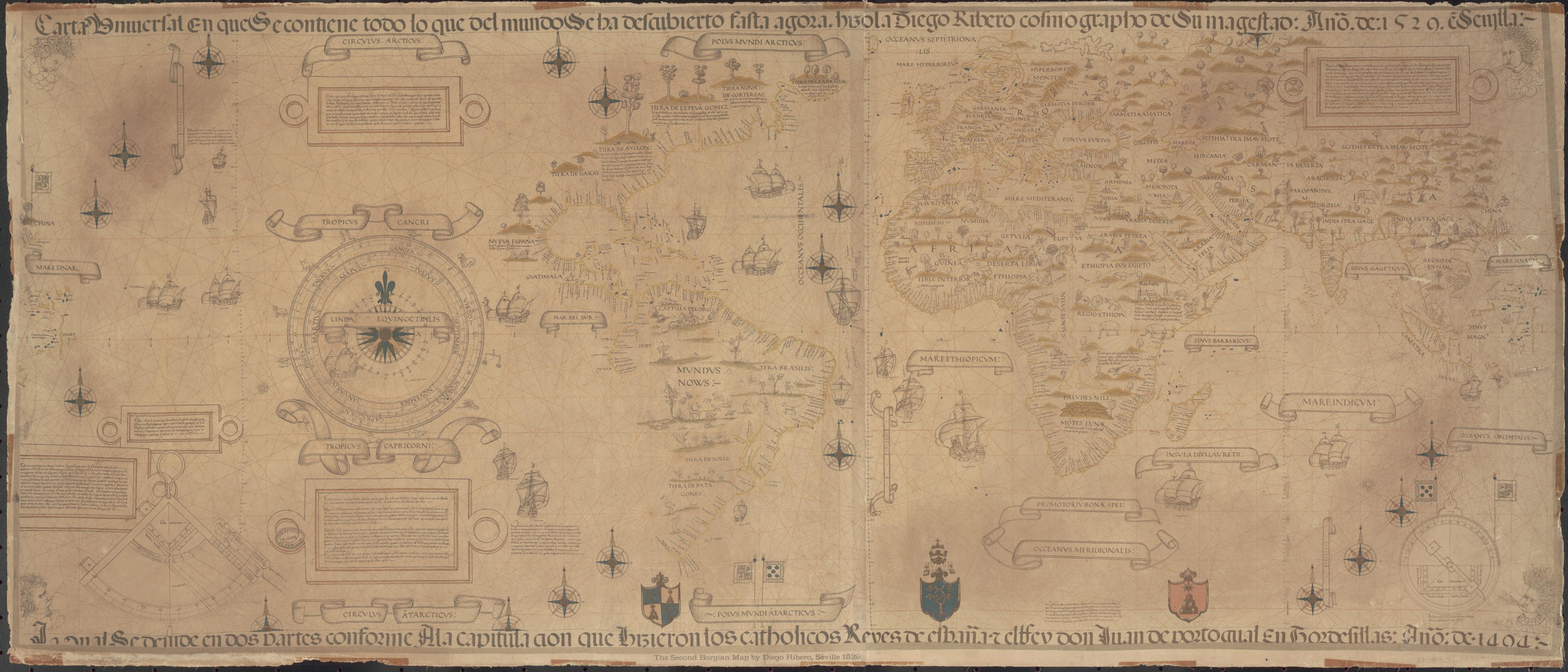
It is important to remember that all ports do not evolve into port-cities, but all port-cities contain a port. The port, however, is only one part of the port-city. A distinct urban form, the latter had a shrine, mosque or temple; housed the apparatus of government (the customs house, the faujdar’s office, which collected dues and ensured that ships provisioned only necessary grains and edibles, and sometimes a mint); and had a bazaar to conduct business in what were termed ‘ready-money sales’. The French traveller Luillier saw two markets at Hugli in 1705, one for daily needs and the other for spot sales of goods brought in from the interior.
We must not confuse the port-city with a ‘city with a port’, like Kuala Lumpur (Port Klang) or Rome (Civitavecchia), which are land cities with outlets to the sea. The Bosnian writer Predrag Matvejevic said, ‘Cities with ports differ from city-ports, the former building their piers out of necessity, the latter growing up around them by the nature of things. In the former they are a means and an afterthought; in the latter, starting-point and goal. Some remain mere anchorages, while others turn into stages and worlds of their own.’
Another category is ports-of-trade, entrepôts which were formally administered as the opposite of free ports. Such entrepôts were also found on land — caravan cities like Samarkand, Lar, Balkh and Herat were ports-of-trade.
To sum up, the port contains physical infrastructure (harbour, docking berths, toll booth, storage), and the port-city reconciles religious and commercial interests via the apparatus of administration. The maritime city supposedly managed intangible social, political and economic assets. But it is not so easy to separate these categories.
II. Classification problems
The interchangeability of port-city and maritime city continues to puzzle us. Both are characterised with regard to four main factors: politics, economy, culture and population/migration. In politics, they are independent, not usually governed by a large state. In economy, both are major nodes in wider economic systems, playing roles in transit, production and finance. In culture, they are cosmopolitan, gathering and displaying creativity in art, architecture and knowledge. In population, they are heavily migrant and polyglot; they fluctuate through continuing migration, and they have a steep social hierarchy ranging from wealthy elites to the very poor.
The maritime city can approximate a city-state, and again we face a problem. World historian Patrick Manning saw city-states rising through commercial expansion, like Tyre in Lebanon. Colonists from Tyre built Carthage, which grew through trade. Athens followed by expanding the trade of the north-east Mediterranean. Athens, Carthage, Venice, Amsterdam and Zanzibar expanded from city-states to become centres of large empires. Hormuz shifted among the categories of city-state (15th century), colonial port (under the Portuguese in the 16th century) and imperial port (under Iranian rule in the 17th century). Kilwa, Malindi and Mombasa rose in medieval Africa. A central port-city like Aden resembled a city-state before being absorbed into the Rasulid state. City-states like Athens and Carthage were essentially land-bound network cities, while Amsterdam, Venice, Zanzibar and, more recently, Doha, Singapore and Hong Kong are maritime network cities.
Not necessarily situated on the shore, the maritime city could be a capital in the interior, like Golconda-Hyderabad, which is known as ‘Pearl City’! British Calcutta and Mughal Dhaka were capitals and maritime cities, but both rose on rivers. Calcutta did not greatly rely on its river in conducting its main business, which was commissioning textile production. It was qualitatively different from a Mughal port-city like Surat or an inland commercial centre like Agra.
III. Maritime city
Therefore, although discontinuous in space and time — now scattered, now more condensed — our search for the elusive maritime city continues. What is the order that sustains such cities, the rules that decree how they rise, take shape and prosper, adapting to the seasons, objective conditions and forces of circumstance? How do they die? Specifically, how do they rise, what are their functions, and what are their attributes?
According to Sinappah Arasaratnam, drawing on Walter Christaller’s concept of central coordinating cities, the emergence of a maritime city in a particular location ultimately depended on its ability to command the flow of goods through that location. Other factors were the region’s international orientation and its urban adaptation as a survival mechanism. The maritime city grew through the strength of its links to other centres: Sonargaon-Taicang, Calicut-Aden, Dabhol-Mocha and Surat-Hormuz. They had elaborate edifices: citadels or forts, city walls and fortifications offering protection from land and sea. Different connections lie at the heart of the production of different kinds of spaces, and these spaces became social locations embedded in webs of cultural, social, economic and political exchange. Thus, they could be long-lasting central cities. They were also sometimes more short-lived network cities, another concept that I will elaborate on.
The maritime city worked through the dual functionality of port and political entity and a notable balance between centrifugal politics and centripetal economics; these two were visible, Southeast Asia historian Eric Tagliacozzo says, in stable port-capital-hinterland relations. Its primary purpose was to offer protection to its itinerant population and visiting communities: foreign merchants, mercenaries, adventurers, pilgrims and scholars. So it had a large but seasonal population, depending on the ebb and flow of trade, which in turn was dependent on a sailing season dictated by monsoon winds.
Not necessarily situated on the shore, the maritime city could be a capital in the interior, like Golconda-Hyderabad, which is known as ‘Pearl City’! British Calcutta and Mughal Dhaka were capitals and maritime cities, but both rose on rivers. Calcutta did not greatly rely on its river in conducting its main business, which was commissioning textile production. It was qualitatively different from a Mughal port-city like Surat or an inland commercial centre like Agra. It was an occupationally specialised site; it looked towards the ocean, and it attracted migratory merchants, artisans, skilled workers and capital, along with goods, from the interior. For the first time in South Asian history, Tirthankar Roy wrote, the port was not dependent on the hinterland; the hinterland came to the port. So, location is not necessarily important.
The maritime city could be divorced from politics, but not always, as studies of Dabhol and Surat reveal. It worked on trust among big bankers, merchants, moneylenders and shipowners, and it functioned on an understanding between this group and the state. It had shipyards, fishing villages and, importantly, the mint, enabling it to manage the currency and determine exchange rates. Access to a money market was essential.
As a logistics hub at the centre of transport and production networks, the maritime city directed commerce, managed production, determined supplies from arangs and karkhanas and oversaw distribution through bazaars. It controlled weights and measures, and provisioned overland and seaborne trade as well as supplying items of daily need. Between 1708 and 1770, members of the Patna, Murshidabad and Dhaka ruling elite established and owned over 20 wholesale and daily bazaars. Ownership was not just an economic affair; it was symbolic of social and financial power.
IV. Chittagong
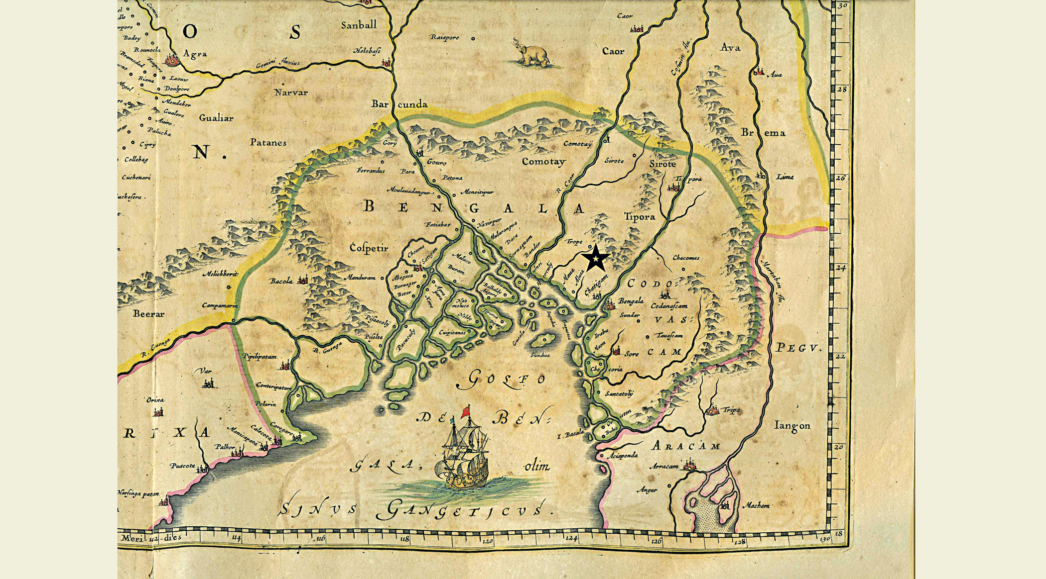
Despite its commercial prominence, only Mughal Hugli qualifies as Bengal’s maritime city. As it was short-lived, I ask: can Chittagong, at the frontier of South and Southeast Asia, be Bengal’s maritime city? Unfortunately, due to its frontier location, its rich history — in material matters such as trade and in the opportunities it offers to see world historical processes at work — is virtually unknown to the field of maritime history.
Chittagong’s trans-regional reach enabled it to play a significant role in the Bay economy. The Markandeya Purana validates this reach but also highlights its marginality by placing it in a region it calls Bhadrasva-varsha, not Bharatavarsa. Chittagong’s political borders were weak, and Abdul Karim sees its status as a capital city as doubtful. David Ludden saw no ethnically distinct population that could evolve into a cohesive elite class. Those inhabiting Chittagong combined their efforts with local assets but took away resources such as bullion and people, unlike those who live inside a defined territory and enjoy proprietary authority over resources, which they invest to accumulate further resources there itself. Combining productive powers and reconciling the conflicting interests of territorialism and mobility is an elite speciality, something not seen in Chittagong.
Clearly, the maritime city is a network city. One succeeded another, like Gujarat’s Diu-Cambay-Ghogha-Dabhol-Chaul-Surat complex; Kanara’s Honawar-Bhatkal-Barkur-Mangalore-Kasaragod; Malabar’s Kulam Mali/Kollam (Quilon)-Panatalayani Kollam (Fandarina)-Kochi-Calicut-Kannur; and Bengal’s Satgaon-Hugli-Calcutta and Sonargaon-Dhaka complexes. Operating in isolation, Chittagong was not a network city like these functionally complementary ports.
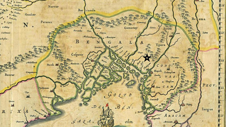
Chittagong does not fulfil the criteria of either a maritime city or a city-state, because its urban hierarchy and social order lack definition. Maps and texts do not indicate the elaborate physical infrastructure found in other port-cities. There were some religious edifices: the shrine of the 14th-century Sufi preacher Badruddin Allama (variously known as Shah Badr, Badr al Din Auliya and Badr Pir — guardian of rivers), some mosques, and the 18th-century Chatteswari temple.
Its religious ties are obscure, but the influence of its patron saint, Badr Pir, is pervasive. It can be seen in the place names Badartila (Hathazari thana), Badarkhali (Chakoria thana) and Badarkua (Cox's Bazar), as well as in the many 9th- and 10th-century Badr Maqam shrines on boulders and crags at river mouths. These marked a maritime circuit and were worshipped at by Hindus, Muslims, Chinese sailors and local fishermen at Akyab, Cheduba, Thandwe and Mergui.
These land and sea networks leveraged economic strength, and Chittagong operated as a hinge between two commodity circuits: the Indian Ocean network and the river-borne Brahmaputra-Himalaya-Tibet-Yunnan network, which linked it to Sassanid Persia via Pundravardhana. A robust economy ensured that Chittagong issued the silver harikela coins from ca. 665, while from 600 until 1200, Pala Bengal’s monetary system relied on moneys of account supplemented by cowrie shells. A third circuit took cowries across the seas from the Maldive Islands, through Bengal’s rivers and across the mountainous Arakan Yoma, linking Chittagong’s agrarian frontier with India, China, the Arabian Sea, the Bay of Bengal and larger oceanic networks.
Chinese descriptions foreground Sonargaon as a maritime city. Chittagong was merely the port of arrival. Ma Huan’s The Overall Survey of the Ocean’s Shores said in 1433: ‘Travelling by sea from the country of Su-men-ta-la (Sumatra) … the (Nicobars) are sighted, (whence) going north-westward for 20 li one arrives at Chih-ti-chiang [Chittagong]. (Here) one changes to a small boat, and after going 500 odd li, one comes to So-na-erh-chiang [Sonargaon], whence one reaches the capital. It has walls and suburbs; the king’s palace, and the large and small palaces of the nobility and temples, are all in the city. They are Musulmans’.
Around 1436, Fei Xin’s The Overall Survey of the Star Raft saw Chittagong as a seaport, the fluvial port of Sonargaon as the south-east’s political centre and maritime city, and inland Pandua as the capital: ‘This country has a sea-port on a bay called Ch’a-ti-chiang; here certain duties are collected … After going 16 stages (we) reached So-na-erh-chiang which is a walled place [attribute of a medieval city] with tanks, streets, bazaars, and which carries on a business in all kinds of goods. (Here) servants of the King met (us) with elephants and horses. Going thence 20 stages (we) came to Pan-tu-wa [Pandua] which is the place of residence of the ruler’.
V. Reconciling port-city, city-state and maritime city
I now evoke two spatial concepts — German geographer Walter Christaller’s Central Place Theory and Paul Hohenberg’s and Lynn Hollen Lees’ network system — to understand Chittagong’s urban nature. Christaller wrote in 1933 of primate or ‘central cities’ coordinating the production and trade of smaller cities. For Hohenberg and Lees, central place towns belong to the middle zone of the network system. The spatial features of the network system are largely invisible on a conventional map: trade routes, junctions, outposts and gateways show an ordering of sites that are functionally complementary. Within this, certain economic functions form a privileged core within a given network and group into special zones. Other functions, mostly routine, characterise its peripheral zones. The key systemic property of the city here is nodality as opposed to centrality, and the influence of a network’s main city is more unstable than that of the central place, whose dominance tends to be stable by virtue of its placement at the top of the urban pyramid. In contrast, core cities in the network system vary as the intensity of exchange varies, when luxury items are transformed into everyday necessities or when routes interchange.
Manuel de Landa saw yet more differences. Network cities hold strategic posts rather than impose their rule over ever-increasing territory, as central cities tend to do in order to control trade routes. Network-system cities are mobile gateway cities, penetrating the markets of central cities through the gateways, while the more static central cities need to tap increasingly into the reservoirs of distant lands through invasion and commercial expansion.
VI. Understanding the maritime city
Clearly, the maritime city is a network city. One succeeded another, like Gujarat’s Diu-Cambay-Ghogha-Dabhol-Chaul-Surat complex; Kanara’s Honawar-Bhatkal-Barkur-Mangalore-Kasaragod; Malabar’s Kulam Mali/Kollam (Quilon)-Panatalayani Kollam (Fandarina)-Kochi-Calicut-Kannur; and Bengal’s Satgaon-Hugli-Calcutta and Sonargaon-Dhaka complexes. Operating in isolation, Chittagong was not a network city like these functionally complementary ports.
We can better understand Chittagong’s urban nature if we see it as a minor ‘central place’. Why am I calling Chittagong a minor place when I have previously highlighted its trans-regional reach? As a primate city, Chittagong was a central place, but it was located on an isolated coast. A region’s representation and public image are the products of status and power, but this coast was contested. Consequently, Chittagong had no political agency. An indigenous economic elite could not develop, and it could never become a trading city-state of the kind noted elsewhere. Although it dominated an exchange economy for a long period, in the absence of elites, Chittagong failed to leverage its position. In the absence of political authority, its mint operated intermittently, issuing coins for just 53 years: from 1398 to 1448, and again from 1523 to 1526. It did not become a maritime city.
Rila Mukherjee is a historian and the author of India in the Indian Ocean World: From the Earliest Times to 1800 (Springer Nature, 2022) and Europe in the World from 1350 to 1650 (Springer Nature, 2025).
Send your articles for Slow Reads to slowreads@thedailystar.net. Check out our submission guidelines for details.

The many worlds of Ghulam Murshid
Operation Jackpot: How Bangladesh’s naval commandos struck at Pakistan’s lifeline in 1971

The Yellow Butterfly: How Sheba shaped my world growing up

What Bangladesh’s historic Test victory in Australia means for Bangladeshi-Australians

Remembering Sumit Sarkar, a historian who questioned orthodoxy
The unfinished histories of Partition
In conversation with William Dalrymple / ‘Britain didn't conquer India’
Sheikh Mujib’s killing: What the newspapers told and what they omitted

Mirrors of Empire / The bureaucrats and intellectuals who shaped the Mughal Empire